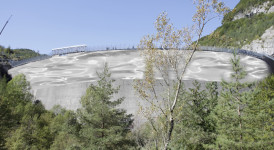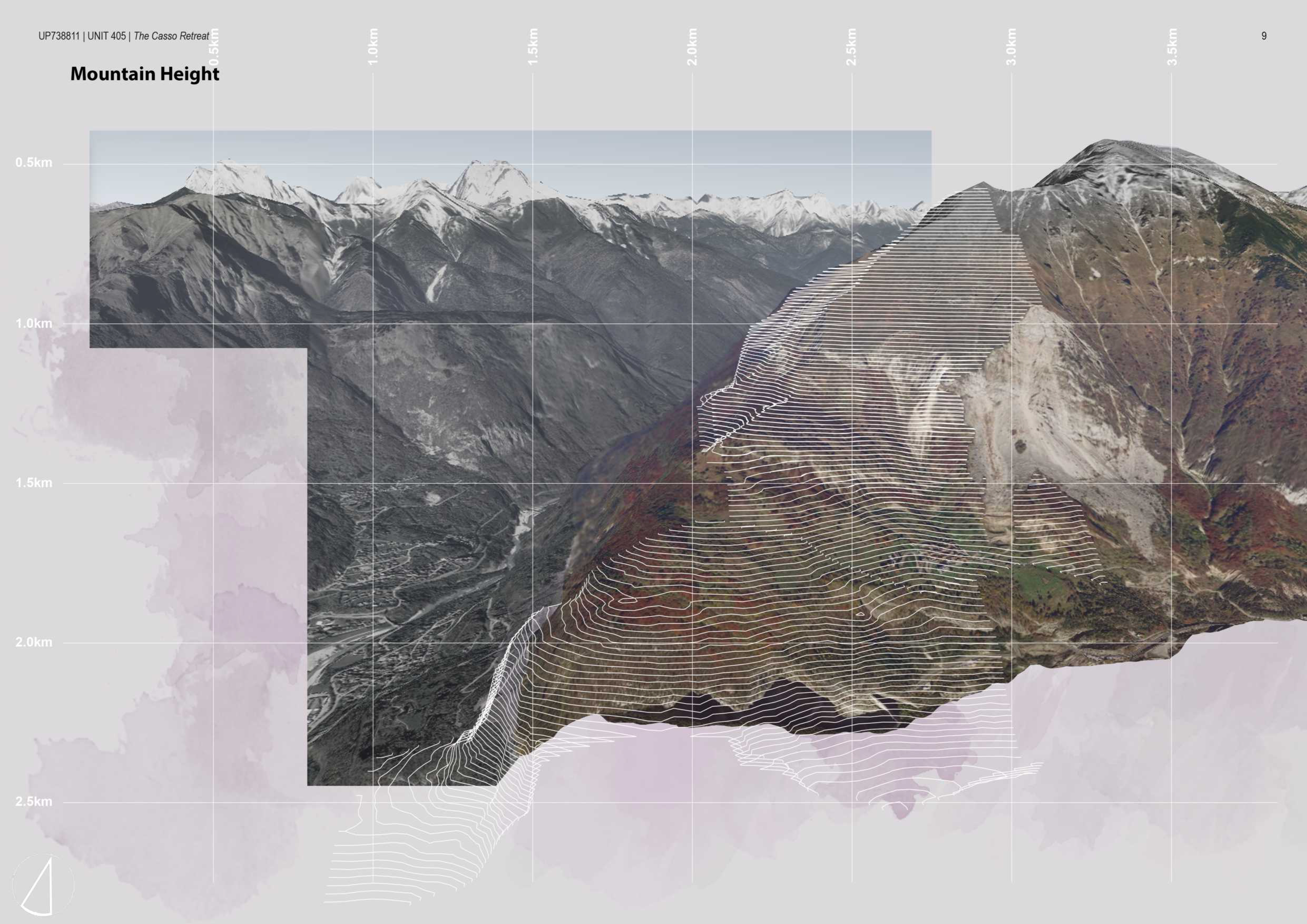
The landslide swept part of an entire landscape downstream while practically keeping intact the same land formation where the eastern and western lobes and Rio Massalezza are still visible, although this stream now flows from north to south in the opposite direction from the original.
In this way the landslide gave rise to a ‘mirror image’ which recalls the previous landscape, originating a geography which has become both a result and testimony of the catastrophic event which had caused it.
Hence, through an interpretative reading, there is the desire to make the causes and effects that have given rise to the formation of this new territory understandable.
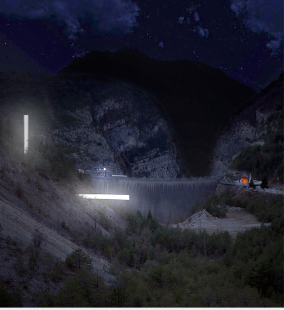
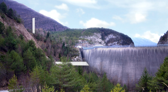
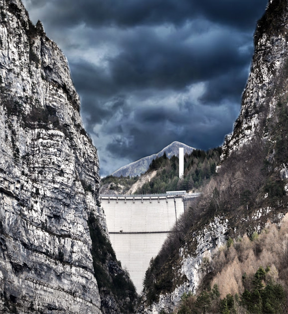
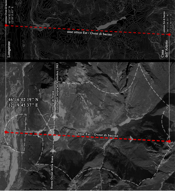
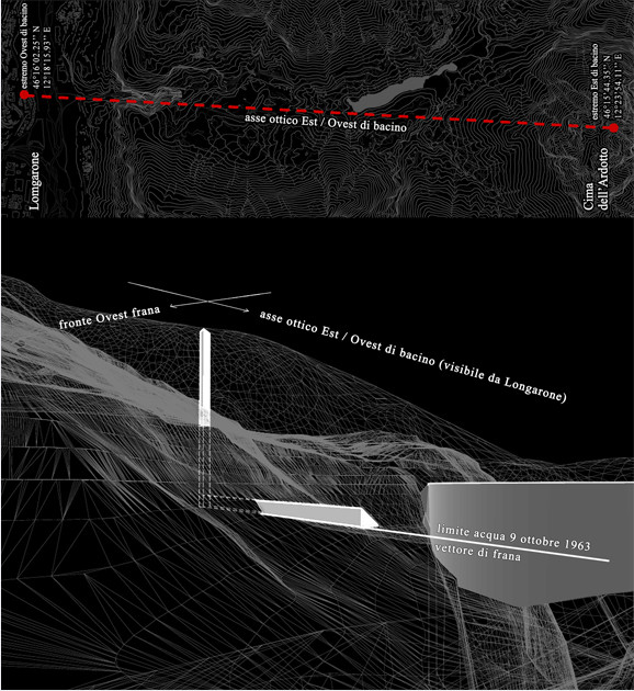
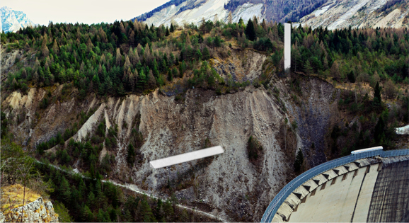
A prism, of basic geometry, equipped with two arms that are orthogonal to each other, placed within the territory in the position of 46°16’02.19’’N 12°19’45.37’’.
It is visible over the long distance with the point of view in Longarone given the territorial dimension of reference.
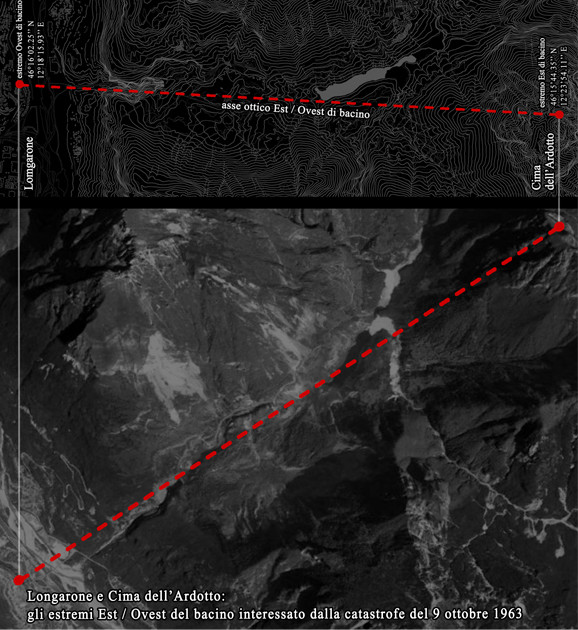
A “signal” that lets the viewer detect the order:
1. The longitudinal axis (the axis is also the geometrical visual axis) of the basin of the catastrophic event object whose geographical extremes are east of the Cima dell’Ardotto and west of Longarone
2. The western border of the landslide
3. The direction of the landslide motion
4. The water level in the reservoir at the time of the catastrophe (triggering the process of territorial change)
These physical elements thus identified allow an understanding within the basin (point 1), cause (point 4), part of the effects (points 2,3) that have determined the current geographical basin structure.
The “signal” clearly reveals core traces which guide an understanding of the new territory, traces that uncover its history.
In the night, the two lit arms refer to the place, in its visible aftermath.
Features:
Vertical-horizontal H arm spatial structure measuring 18,00-36,00 ml in Al/steel; anchoring structures in Cls; Barrisol/Starpath coating (sensor light for night lighting).
–
La grande frana ha trascinato a valle un’intera parte di paesaggio mantenendo pressoché inalterata la sua conformazione dove i lobi est, ovest e il mediano Rio Massalezza, che ora scorre da nord a sud in senso opposto a quello originario, sono tuttora leggibili.
La frana ha dato così luogo a un paesaggio “specchiato”, identica memoria della precedente realtà, originando una geografia che diviene esito e narrazione dell’evento catastrofico che l’ha prodotta.
Da qui la volontà di rendere comprensibile, tramite un esercizio di lettura, le cause e gli effetti che hanno dato luogo alla formazione di questo recente territorio.
Un prisma, dalla geometria elementare, dotato di due bracci tra loro ortogonali, posto nel territorio in posizione 46°16’02.19’’N 12°19’45.37’’E, leggibile da grande distanza con Punto di Vista in Longarone data la dimensione territoriale di riferimento.
Un “segnale” che permette all’osservatore di rilevare nell’ordine:
1. l’asse longitudinale (l’asse geometrico è anche asse visivo) dell’area di bacino oggetto dell’evento catastrofico i cui estremi geografici sono a est la Cima dell’Ardotto e a ovest Longarone.
2. il limite ovest di frana.
3. la direzione del moto franoso.
4. il livello dell’acqua all’interno dell’invaso alla data della catastrofe (innesco del processo di modifica del territorio).
Tali elementi fisici così individuati permettono di comprendere, all’interno dell’area di bacino (punto1), causa (punto 4) e parte degli effetti (punti 2,3) che hanno determinato l’attuale assetto geografico di bacino.
Il “segnale” palesa le tracce fondamentali da cui muovere per la comprensione della nuova geografia, tracce che ne svelano la storia.
Nella notte i due bracci illuminati rimandano al luogo, leggibile all’indomani.
Caratteristiche:
Braccio verticale-orizzontale H ml 18,00-36,00 in struttura spaziale di Al/acciaio; opere di ancoraggio in Cls; rivestimento in Barrisol/Starpath (captatore di luce per illuminazione notturna).

 parma
parma
Tuesday, June 15th 2021, 2 – 4 PM, webinar panel:
two calls for vajont: fase _restart.
Vajont: [...]


